≡ Menu

Bio Retention

An attractive stormwater solution

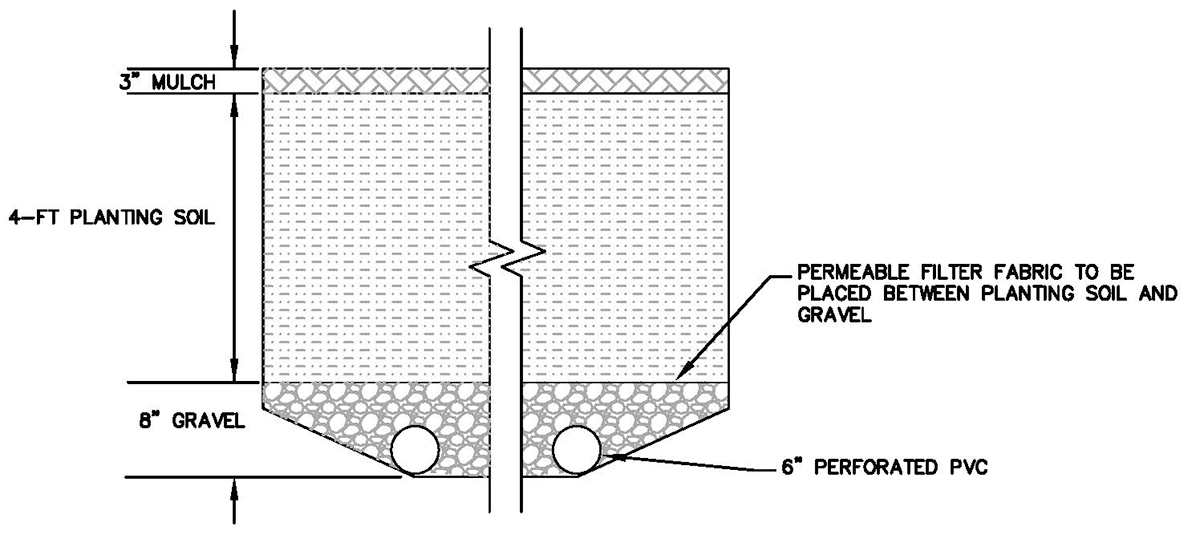
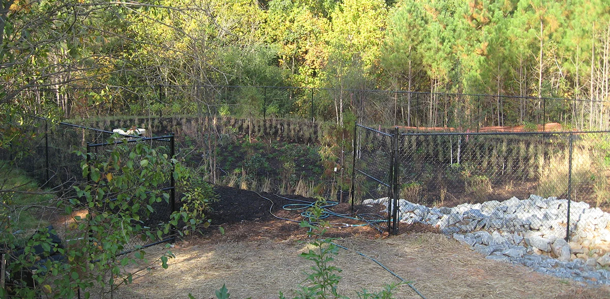
Bio retention areas are one of the best management practices (BMP’s), or methods, by which storm water can be filtered as required by many municipalities in metro Atlanta and other areas. A bio retention area is a filter consisting of various layers of filter media. As layered from bottom to top, there is a gravel area with under-drains, a depth of engineered soil designed to drain water, and a 3-inch layer of mulch on top planted with specific landscaping. The landscaping used for bio retention areas is not only tolerant to inundation of water, but also absorbs pollutants. The mulch filters larger particles of pollution in incoming stormwater, holds moisture for the vegetation, and prevents erosion of the soil below.

Engineered soil filters the fine particles of pollution, and the gravel under-bed collects the water filtered from above and pipes it into the storm sewer system downstream. All elements act together to filter the initial runoff which contains the greatest amount of pollutants.

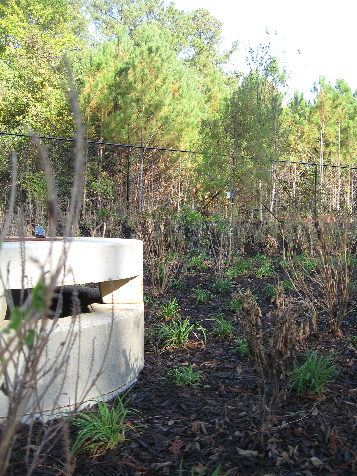
One of Partain Engineering’s recently completed projects is a fellowship hall addition to Johns Creek Presbyterian Church in Johns Creek, GA. In order to meet the city’s water quality requirements, we designed a bio retention area to provide water quality for the proposed impervious area. A bio retention area was selected due to the city’s restrictions and site constraints and was added adjacent to the site’s existing stormwater detention facility.
While a bio retention area is more expensive than some BMP’s that might have been allowed in other municipalities, it can be an attractive alternative to treat stormwater while, at the same time, meeting city requirements. This measure can also, in some cases, help reduce or eliminate the need for stormwater detention.
Driveway Regulations

Revised regulations on state right-of-way in Georgia

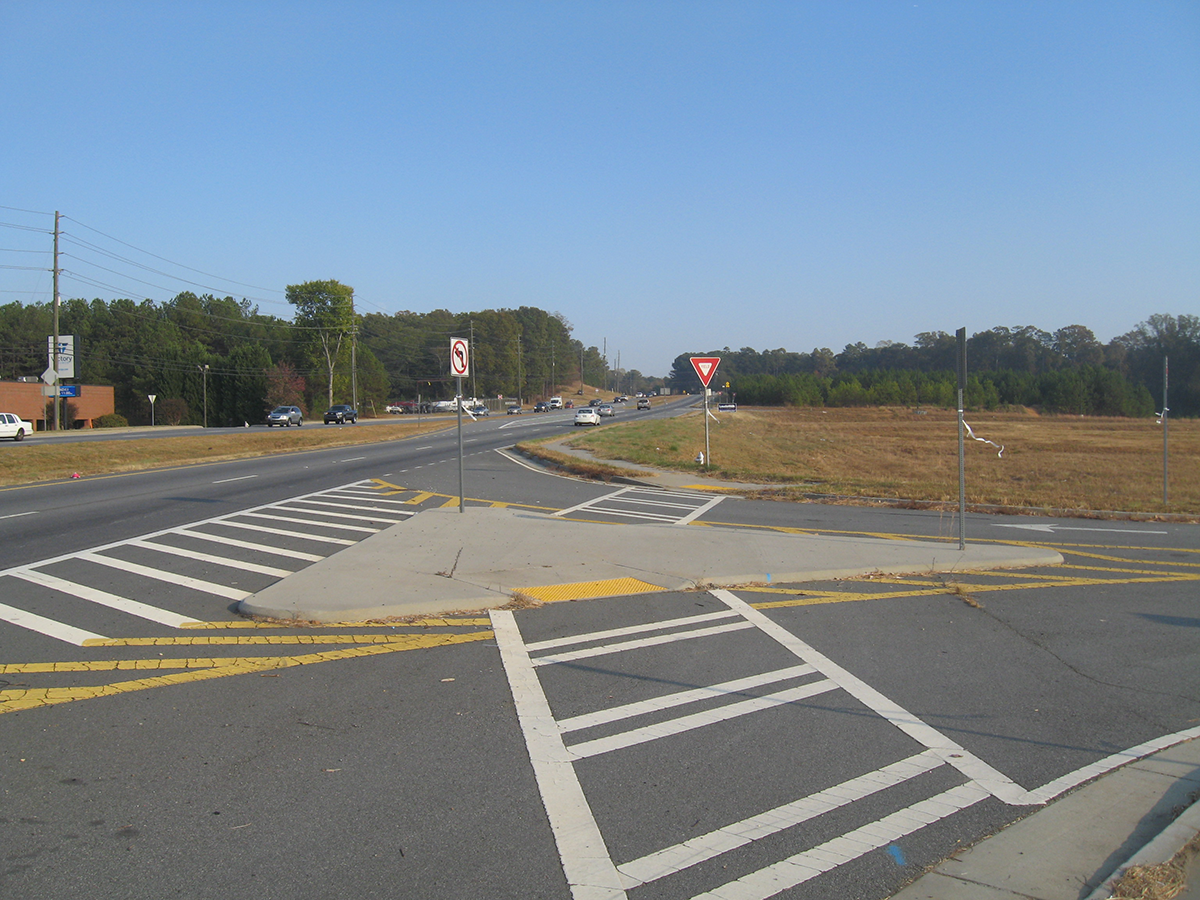
Last year, the Georgia Department of Transportation revised its regulations for driveways and encroachments into state right-of-way. Much of the manual has not changed. However, some of the revisions the state has made may affect your project planning and cost:

  • Driveway spacing criteria has been revised to require driveways to be farther apart. The revisions apply to the spacing of offset driveways on the opposite side of the street.
  • The spacing requirement for signalized intersections has increased from 1000-ft to 1320-ft in urban areas and has doubled from 1320-ft to 2640-ft in rural areas.
  • If you wish to remove dirt from the right-of-way in front of your property, GDOT can either set the price per yard or ask that you haul it to a location they specify. The previous version of the manual set the compensation price at $1.00/cubic yard.
  • More detail is required for plan submittal to show billboards. Also, tree inventories are required if tree removal is proposed in the right-of-way.
  • For deeding of right-of-way for road improvements, more information is required to show a clear title, including preliminary and final title reports. These must be furnished by the applicant proposing the road improvements.

Having access to a proposed development is a key determinant in whether a project is feasible and can move forward to examine other issues of feasibility. Increased spacing of driveways and traffic signals could cause significant access challenges for some sites, possibly rendering them unusable. Site circulation may be affected for sites where access is not an issue.

The subjectivity of GDOT compensation terms for cut in the right-of-way could negatively affect project cost and should be considered in the planning stages of a project. Also, additional project design costs will likely result from having to identify billboards and inventory trees on plans as well as providing the necessary documentation to show a clear title for deeding of right-of-way.

Your project civil engineer should be aware of these requirements and be able to help you navigate through them. However, engaging the professional engineer in the early stages of project planning may prevent the new regulations from being a stumbling block later.

Land for Sale!

$1,000,000 per acre … but you don’t get the acre

I had a client who had purchased a 1 acre piece of property for $250,000 to build a community center in close proximity to a college campus. The real estate agent had told this client that the property was completely usable except an area at the rear of the property where there was a small stream. It turns out that this small stream drained several square miles upstream of the site, i.e. the stream was not so small.

As I begin to dig into the details of this site, the stream had a buffer associated it, (like most streams in Georgia, that’s where this site is located). However, due to it’s proximity to a water intake downstream, the normal 50-ft buffer requirement was required to be doubled to 100-ft.

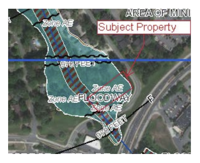
In addition to the buffers, almost the entire property from curb to stream was in the 100-year federally regulated floodplain. See excerpt from FEMA floodplain map below (the flood plain area is in cyan and the approximate parcel area is traced in red).

With some clever landplaning we were able to develop a plan that allowed the construction of the client’s building (albeit on stilts) and a small parking lot utilizing ¼ of an acre of land. This was about all the usable acreage that could be developed and still meet the stringent stream buffer and floodplain requirements.

Net result, about a quarter of the land the client purchased was actually usable. That’s right, the effective cost of the usable land was $1,000,000/acre.

This is not the first time we have seen a similar situation and I’m quite sure it won’t be the last. It is so important to hire a site planning consultant to investigate the restrictions on a piece of property that may not be obvious at first glance BEFORE purchasing the property. 🙂

How to Get a Good Land Survey

When developing real estate, a good land survey is important. Many times clients come to us with old surveys or surveys that simply do not have enough information to adequately analyze the property for problems or develop detailed civil/site plans. In many cases, we recommend that the client have their survey revised to include the additional needed information or that they start over altogether.

Below are some things to think about before you get ready to engage a land surveyor:

To ALTA or Not to ALTA

In many situations we recommend that our clients obtain an American Land Title Association, or ALTA, survey. Obtaining an ALTA survey not only engages the effort of a registered land surveyor but also a title attorney. The title attorney will perform a detailed search for any encumbrances on the property and generate a report of their findings. This is known as a title report. The title report is then given to the surveyor who can put any found encumbrances on the survey such as easements, deeding of property to neighbors or local departments of transportation. When property changes hands or easements are granted, the transaction doesn’t always get disclosed. An ALTA survey should bring such things to light.

Location of Underground Utilities

Many-a-dollar has been lost by not requiring the land surveyor to have a private utility locator to locate underground utilities that are difficult if not impossible to locate otherwise. It is very important to have such underground utilities such as natural gas, power, water lines, and communication lines just to name a few. In our experience working around hospitals, you can find there are additional utilities that need to be located such as medical gas lines, steam lines, or chiller lines. All of these are important to locate up front as locating them while under construction usually results in surprise costs and delays.

Every Which Way but Up

Topography is also essential as it can help to obtain ideas about how the site and proposed building may function. It can help to answer questions such as: Will retaining walls be necessary? Will dirt have to be hauled from or in to the site to develop it? It can also be helpful to see how feasible it may be to connect to a gravity utility such as sanitary sewer. For example, I have seen sites that were situated in a “hole” from the road and the sanitary sewer was at the street. Situations such as this can affect project cost and feasibility.

Summary

It is a good idea for more reasons than mentioned above to get a quality land survey. One key to ending up with a good land survey is knowing what you need and how to communicate those needs to the surveyor. At Partain Engineering, we have assisted numerous clients ordering surveys. If you would like assistance in obtaining a survey, then simply go to our contact page and email us.