Occasionally, we have clients with residential drainage problems. Sometimes the solution is obvious and sometimes it is not. Obvious or not, many times you need to seek professional assistance to determine a solution. Below are five common types residential drainage problems that we have helped home owners solve and suggested solutions.
- Ponding Water
Often times low areas that trap water may exist on a property. Depending upon where these areas are located they can contribute to flooding or water damage if they are close to a building. Different conditions require different solutions.
Sometimes the problem can be attributed to erosion that has altered drainage patterns to create the low spot or it can be that an area was graded improperly. In each a case, regrading the area to remove sediment deposits due to erosion or reshaping the terrain to drain in a positive manner in conjunction with stabilizing the area with ground cover may be the answer. This could be as simple as a DIY project with a shovel or could require a contractor with mechanized equipment.
In certain situations, regrading may not be the answer but the installation of a drainage structure in the low area. This may beyond the scope of a normal DIY project and could be a solution that requires mechanized equipment or hiring a contractor to install the drain and insure that it drains properly.
- Eroding Soil
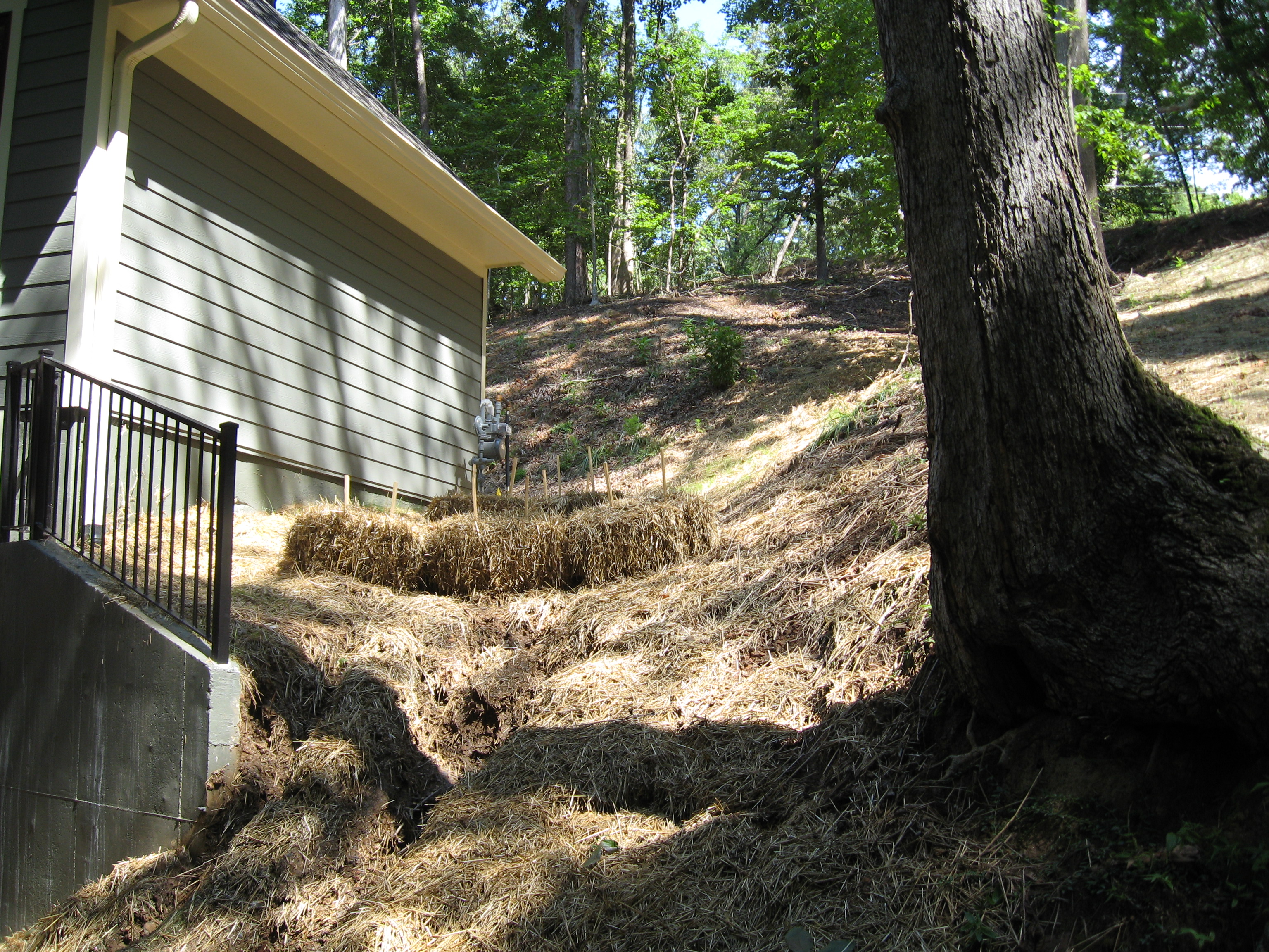
Eroding Slope Temporarily Stabilized with Haybales
This common problem usually is caused by mishandled surface water but can be the result of other problems such as steep slopes that are not stabilized. When a large quantity of storm water is draining to a steep slope, erosion is bound to occur. Sometimes lining the eroding area with large stone (aka, rip-rap) can remedy the problem. However, we have seen instances where this does not work in areas where a considerable area is draining toward the slope. Drainage structures may have to be installed to capture the stormwater before it reaches the slope and pipe it to a discharge point with less erosion potential.
- Drainage Structure Damage or Improper Installation
Damaged drainage structures can cause a variety of problems. Storm drainage structures are intended to capture, contain, and convey storm water. If a drainage structure is damaged, it may not adequately perform any of these intended functions. One of our clients had a residential drainage problem that consisted of storm water ponding in a depressed area adjacent to his back porch. Part of the problem was that the depressed area was located next to an exposed drainage pipe that had been pushed out of the ground and ruptured due to tree root growth. Every time it rained heavily, this broken pipe was filling the depressed area with water. It was obvious that the pipe needed to be replaced and relocated to accommodate the tree root growth while providing positive drainage. Also, the depressed area required a drain to be installed.
- Clogged Drainage Structures or Channels
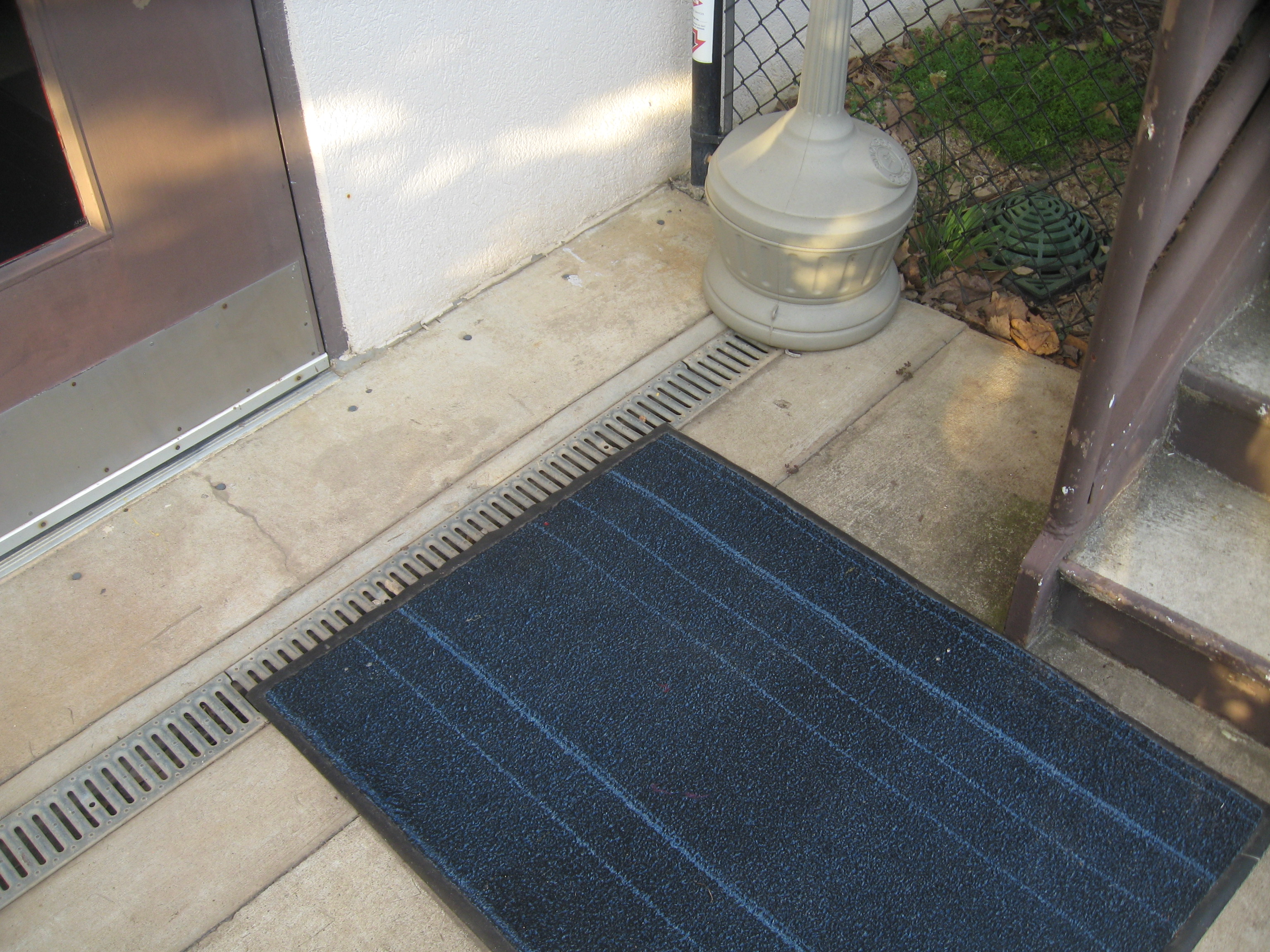
Internal Clogged Drain Pipe Found in this Trench Drain
A clogged drainage structure, such as a pipe or drain, or a drainage channel can cause a variety of problems. One of our clients had stormwater entering a door of their building. Outside of the door was a trench drain that should have addressed the problem. However, unbeknown to the client, the pipe inside the drain was clogged (and undersized) which prevented the drain from working properly. The obvious recommendation was to replace the pipe with a larger pipe that would not be so easily clogged.
One of our residential clients, who had a variety of residential drainage problems, had a pipe that discharged into a ditch/channel that had filled in with debris and clogged. This was causing stormwater to drain through his yard and eventually to a steep creek bank. The creek bank had severely eroded due to this concentrated flow of stormwater. We recommended that this homeowner excavate the clogged ditch to restore the channel to its originally installed condition.
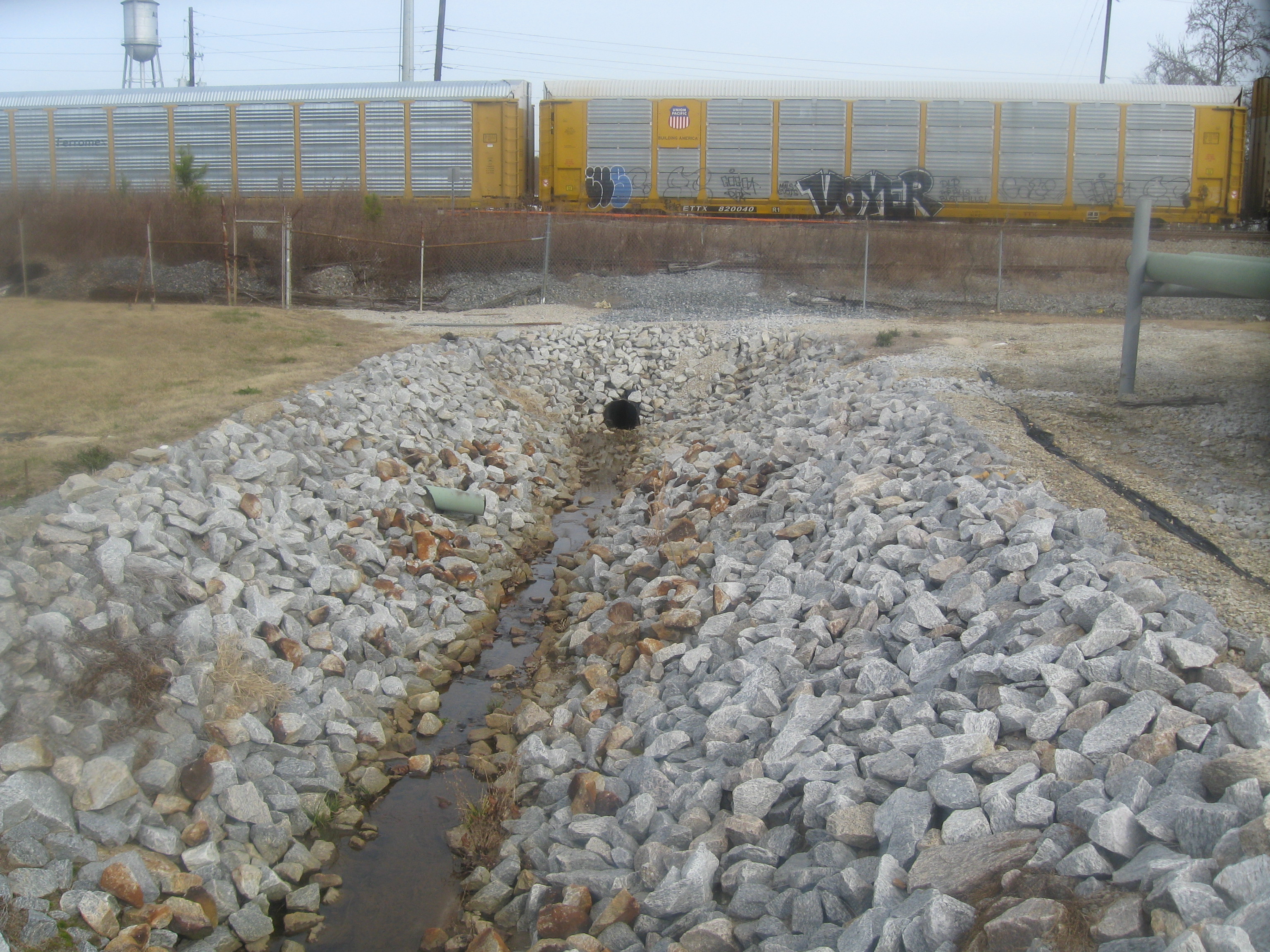
Undersized Pipe
- Undersized Drainage Pipes or Channels
Undersized drainage pipes or channels are not always an obvious problem. They may only cause problems in torrential rains and work fine most of the time. However, when these pipes or channels create a problem, the problem can be a significant problem that no one saw coming. One of our industrial clients had an undersized pipe that drained a creek (along with the rest of their site) that flowed through their site. Most of the time the pipe worked well to drain the creek and the site. However, when a large storm even occurred their loading dock and other areas flooded. The solution to this problem my seem obvious, just install a larger pipe to better drain the creek and site. However, here is where an expert needs to be consulted to answer the question, “How large should the new pipe be?” In this case a design professional knowledgeable in the design of storm sewer is a must.
Summary
Some residential drainage problems are obvious and some are not. Sometimes problems can take years to develop or only be obvious during infrequent storm events. It is important to get an expert involved before property damage or even dangerous conditions develop. Drainage problems can be costly but can be more costly if left unresolved.
 Last year, the Georgia Department of Transportation revised its regulations for driveways and encroachments into state right-of-way. Much of the manual has not changed. However, some of the revisions the state has made may affect your project planning and cost:
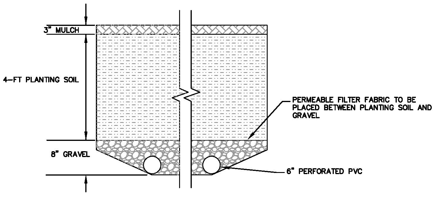
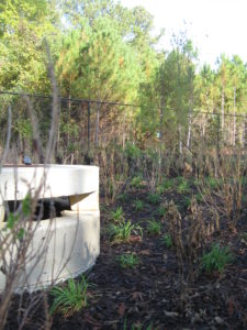 Bio retention areas are one of the best management practices (BMP’s), or methods, by which storm water can be filtered as required by many municipalities in metro Atlanta and other areas. A bio retention area is a filter consisting of various layers of filter media. As layered from bottom to top, there is a gravel area with under-drains, a depth of engineered soil designed to drain water, and a 3-inch layer of mulch on top planted with specific landscaping. The landscaping used for bio retention areas is not only tolerant to inundation of water, but also absorbs pollutants. The mulch filters larger particles of pollution in incoming stormwater, holds moisture for the vegetation, and prevents erosion of the soil below. Engineered soil filters the fine particles of pollution, and the gravel under-bed collects the water filtered from above and pipes it into the storm sewer system downstream. All elements act together to filter the initial runoff which contains the greatest amount of pollutants.